
From Jordan Clayton, U.S. Department of Agriculture
General summary:
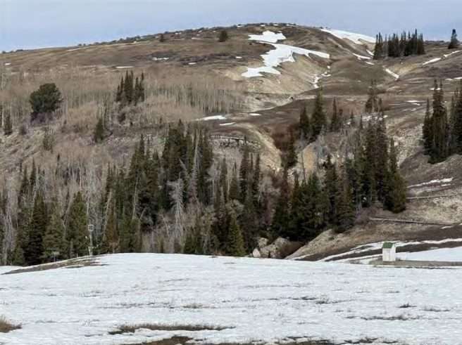
During March, Utah’s snowpack deteriorated from borderline record-poor conditions to completely unchartered territory. After some brief storm activity at the beginning of the month, warm and dry conditions prevailed, causing early ripening and rapid snowmelt. Statewide snow water equivalent (SWE) levels peaked on March 9th which was more than three weeks earlier than normal. Since 1980, only the years 2004, 2007, and 2015 had snowpack peaks as early as the first part of March, and for those years there was a fairly normal rate of SWE loss as snowmelt began. Instead, for 2026 the rate of SWE loss was faster than ever before observed for the month of March, resulting in unprecedented snow conditions for Utah. When the statewide snowpack peaked, it was at 8.4 inches of SWE—nearly two inches below the previous low peak of 10.3 inches observed in 2015. By the time April 1st rolled around, the statewide SWE index had dropped to just 2.7 inches of SWE. At that time, the NRCS-Utah Snow Survey office released a Special Report to make water managers aware that our April 1 snowpack was the lowest ever recorded for the state of Utah, citing measurements dating back to 1930. As noted in that report, the next lowest April 1 SWE in Utah was observed in 2015, but that was roughly five times higher than our statewide value in 2026. For context, the other lowest historical April 1 SWE values for Utah were experienced in 1934, 1977, and 2018. Utah’s 2026 statewide SWE of 2.7 inches was 19% of median (normal for April 1 is 14.2 inches!).
Every major basin in Utah had record-low SWE as of April 1st, and some were almost completely melted-out. Most of Utah’s 140 individual SNOTEL sites were at record-low SWE, with 53 sites (38% of the network) already dried out by then. By one week later, the number of snow-free sites in Utah had increased to 64.
As noted in previous water supply outlook reports this winter, this year’s anomalous snowpack conditions are creating added challenges for runoff modeling. Given the chance that runoff generation from Utah’s mountain areas may be exceptionally poor, we again recommend that water users consider the full forecast range and anticipate that actual April through July volumes may more closely reflect the 70th exceedance probability forecasts than the 50th exceedance values in many cases. We also encourage readers to compare our forecast numbers with those produced by the Colorado Basin River Forecast Center, available here in a side-by-side table.
Water users should anticipate the strong likelihood that runoff generation from this year’s snowpack will be very poor and may break records in some locations. April 1 water supply forecasts for April through July flow in Utah range from 5% to 63% of average for the 50th exceedance probability level, and from close to no flow to 60% of average for the 70th exceedance probability forecasts. Viewed as percentiles, most of these forecast predictions would fall in the bottom 10th percent of previous runoff observations. The area of the state with the largest chance of breaking records for poor snowmelt runoff in 2026 is the Price-San Rafael—potentially true for every forecast point in the basin, depending on if one considers the entire period of record or just the most recent 30 year window.
Utah’s statewide precipitation in March was below normal at 45%, bringing our water-year-to-date (WYTD) precipitation down to 88% of median. Statewide mountain soil moisture levels are at 70% of saturation, which is up 10% from last year at this time and corresponds with around the 90th percentile of observations. The above-normal soil moisture levels in Utah’s mountains is primarily due to the early release of stored water within our snowpack and reflects saturation levels more commonly observed in late April or May. Once this year’s snowmelt has concluded, our mountain soils may experience a longer-than-normal dry summer period, which has the potential to elevate fire risk. We are hopeful for an early and abundant summer monsoon season this year to ameliorate conditions as best as possible. Utah’s current reservoir storage is currently at 69% of capacity (not counting Lake Powell or Flaming Gorge Reservoir), which is down 12% from this time last year.
Surface Water Supply Indices (SWSI) for Utah basins combine our current reservoir levels with the additional volume of water anticipated for each watershed based on these April 1 streamflow forecasts. All areas of the state except for the Bear watershed are projected to have below normal water supply conditions, with 15 of the 19 basins in the bottom 20th percentile relative to historical observations. The potential for exceptionally low surface water supply conditions (relative to normal) is widespread.
The snowpack and water supply picture for the Great Salt Lake (GSL) basin closely mirrors what’s written above for the rest of the state. SWE in the GSL basin is well below normal at 23% of median. March precipitation was 54% of normal, bringing the WYTD value to 91% of median. Mountain soil moisture is close to record-high for this time of year–at 72% of saturation which equates to around the 98th percentile and reflects the early snowmelt. The basin’s reservoir storage is at 73% of capacity, down 12% from last year. Our GSL inflow forecast for April through July flow based on the 70th exceedance probability prediction is 183 thousand acre-feet (KAF), which would be 26% of average and is roughly 80 KAF below our March 1 prediction. For context, the full range of predictions for GSL inflow spans from 125 KAF (90th exceedance value) to 465 KAF (10th exceedance value). Our estimate for how much the lake will rise this spring also spans a wide range, but both the 50th and 70th exceedance probability forecasts would be essentially no change from its stage on April 1st of 4192.3 ft elevation. We remind readers that our estimates for GSL inflow and lake level rise are meant to be advisory-only.